


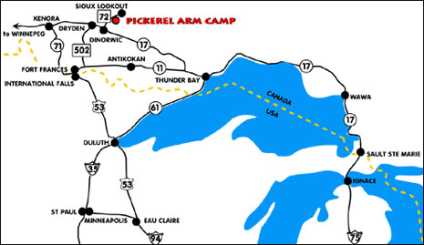
Directions to Pickerel Arm Camp
HOW TO GET HERE
TRAVEL DISTANCES |
|
| Miles | |
| Chicago
Des Moines Detroit Duluth International Falls Kansas City Madison Milwaukee Minneapolis |
815 702 1028 318 150 907 678 705 449 |
BY HIGHWAY
From International Falls, Minnesota. At Fort Frances, Ontario take Hwy. 11 east 17 miles to Hwy. 502 north to Dryden. Take Hwy. 17 east to Dinorwic, then north on Hwy. 72 for 26 miles to camp. (Approximately 150 miles from border)
BY AIR
Land planes can land at Sioux Lookout Airport north of town. Hard surface landing strip, beacon, radio and tower, also commercial landing. The airport code for Sioux Lookout is YXL and for Dryden, it is YHD; International Falls, MN is INL and Fort Frances, Ontario is YAG. All are served by commercial flights daily.
Transfer Service
To and from Sioux Lookout airport $50. Transfer service to and from International Falls is $500.
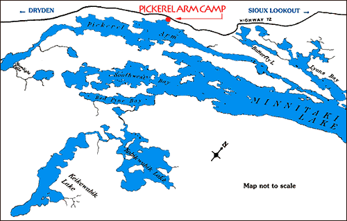
Map
Use the Google map to get customized driving directions from your location
View Larger Map |
SUMMER CONTACT (May 1-October 31) |
WINTER CONTACT (November 1-April 30) |
|
Environment Canada forecast for Sioux Lookout |